

Geographic profiler uses Nazi Berlin to model terrorist activities
Posted by Jayme Blaschke
University News Service
May 27, 2015
It might be hard at first glance to see the connections between a classic German novel, a 1940s Gestapo investigation and state-of-the-art counter-terrorism methods, but a collaboration between Texas State University criminologist Kim Rossmo and Queen Mary University of London mathematical biologist Steven Le Comber has linked all three–and shown how the underlying math could also be used to target infectious disease control.
The novel in question is Hans Fallada’s Alone in Berlin–described by Primo Levi as "the greatest book ever written about German resistance to the Nazis." A fictional version of the real-life case of husband and wife Otto and Elise Hampel, Alone in Berlin tells how in 1940, after learning of the death of Elise’s brother in France, the couple began distributing postcards with anti-Nazi messages in apartment buildings around Berlin, hoping to encourage anti-Nazi resistance. They were discovered, tried and executed in 1943.
The new research is published in Geospatial Intelligence Review–a journal so highly classified that neither Rossmo or Le Comber is allowed to read it–and shows how a technique called geographic profiling could have been used to locate the Hampels within just a few months–when only a small number of postcards had been distributed–instead of the two years and 214 cards it took the Gestapo.
"In this case, of course, we are very much on the side of the 'insurgents,'" said Rossmo. "However, terrorists frequently engage in low-level activity such as leafleting and anti-government graffiti prior to major attacks, and this study shows how geographic profiling could help locate terrorist bases before more serious incidents occur."
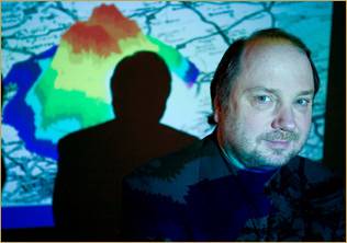
Geographic profiling is a statistical technique originally developed in by Rossmo to prioritize large lists of suspects in cases of serial crime such as murder, rape and arson. The model uses the spatial locations of linked crime sites to identify areas associated with the criminal, such as their home or workplace. It is widely used by law enforcement agencies around the world, including the Metropolitan Police, Los Angeles Police Department, Royal Canadian Mounted Police and the United States Marine Corps. More recently, the model has been adapted by Le Comber to work with biological data.
"The problem is essentially the same," said Le Comber. "But instead of using the spatial locations of crimes to locate the offender’s home, you’re using the addresses of patients with–for example–malaria to locate the breeding sites of the mosquitoes that transmit the disease. In both instances, you typically have a large area to search, with lots of potential 'suspects'–people with criminal records, or water sources such as ponds, water tanks, or drainage ditches–and only limited resources. Anything that can effectively prioritize the search is potentially of huge importance."